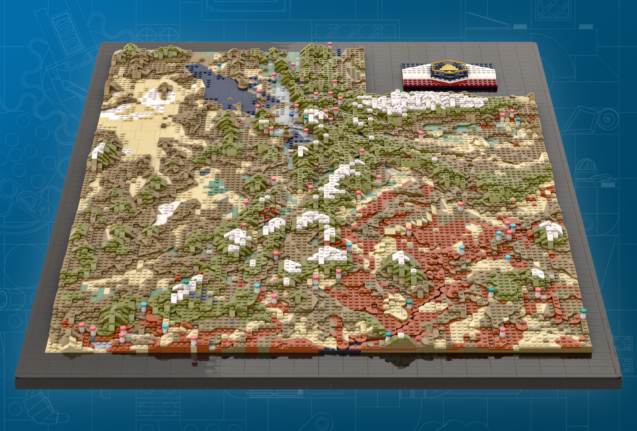
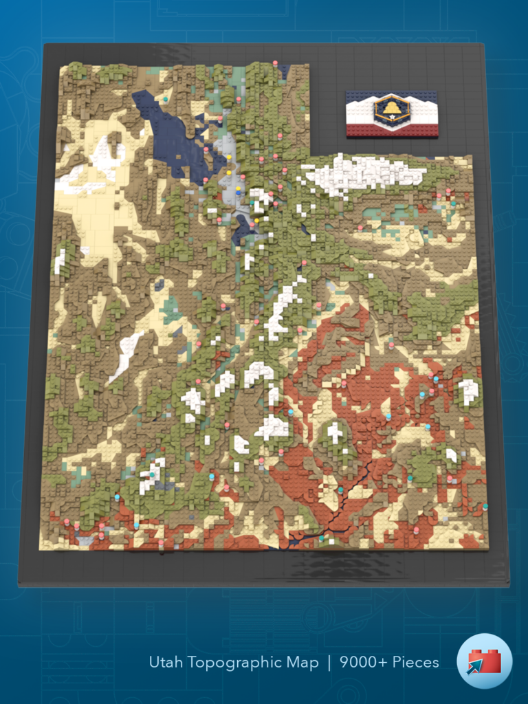
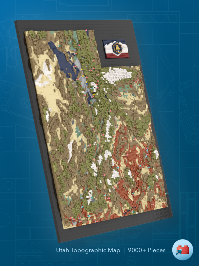
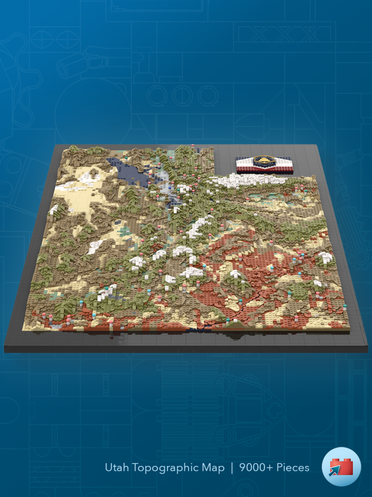
About the Model
This is a scale map of the state of Utah. Each stud on the map has a real-world 3-mile by 3-mile equivalent in the Beehive State1, and each plate of elevation gain is a new 1,000 feet threshold. Mountains and peaks over 10,000 feet have been built in snowy white. The lowest point in the bottom-left corner is at about 2180 feet, and the highest point is in the Uinta mountains, at 13,527 ft – or 11 plates higher!
The colors chosen match the colors you would find from a satellite image – especially the tan, dark tan, and dark orange. Light bluish gray represents developed urban/suburban areas, and sand green is dedicated agricultural land.
Several points of interest are also “pinned” on the map. Coral pink for state parks, dark turquoise for national monuments, and a medium azure blue for national parks. A standard blue marks “You Are Here” (the site of the 2025 BrickSlopes convention), and yellow marks official LEGO stores.
Nestled in the notch in the top-right is the new state flag, including white mountains, a red canyon, and a golden beehive.
About the Build
The challenge of a build like this is in finding angled parts that:
- Are the correct shape to preserve accuracy to reality
- Are the correct color
- Have been physically produced / can be reasonably obtained
- Fit with the other parts around it
There were many instances of trying multiple wedge plate or modified tiles to get the various angles and wedges to fit together, while still providing open studs for connecting the next level.
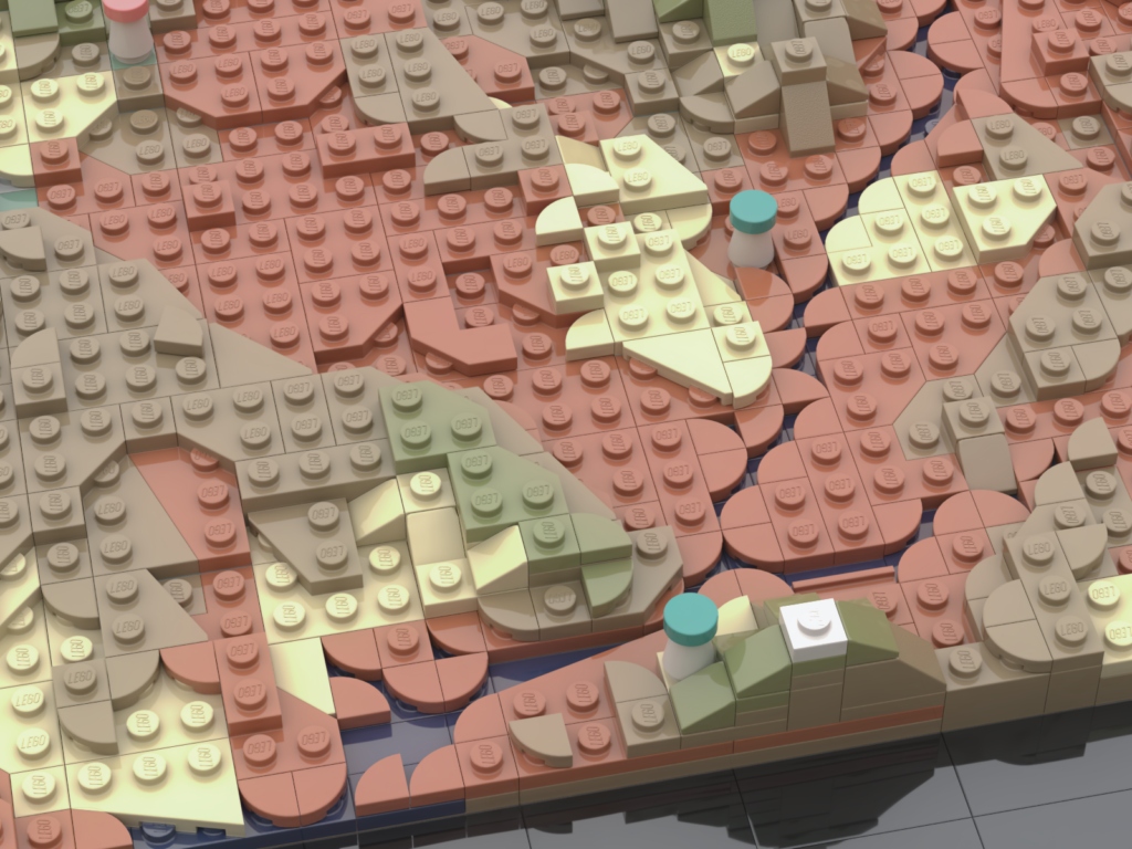
Many AFOLs also appreciate the use of rounded tiles and other parts that allow for a sub-stud gap used to build Lake Powell in southwest Utah. While most rivers are too narrow to appear on a map of this scale, Lake Powell is both wide enough and the canyon walls are steep enough to include it while maintaining scale and topographic accuracy.
Total Pieces
#9211
Unique Pieces
#378
Dimensions
2′ 6.9″ wide
3′ 4.9″tall
2.3″ deep
Digital Renders
Physical Builds
- Some have noted that the footprint of the Great Salt Lake isn’t accurate. The Great Salt Lake has (unfortunately) been sinking at an alarming rate. If this trend can’t be reversed, there are irreversible and frightening ecological impacts in Utah’s future. This map shows the lake at an ideal, healthy level. This is the Utah I want to live in. ↩︎